Ivins light Pollution

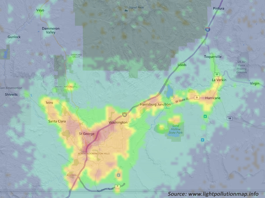
The map below shows 2018 VIIRS data for Ivins and nearby communities. The Visible Infrared Imaging Radiometer Suite (VIIRS) is one of the key instruments onboard the Suomi National Polar-Orbiting Partnership (Suomi NPP) spacecraft, which was successfully launched on October 28, 2011. The interactive map is at www.lightpollutionmap.info.
Interpreting the map colors

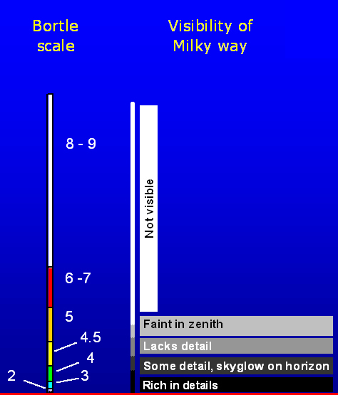
As the map gets closer to red, the ability to see the Milky Way starts to disappear. It is visible in areas shaded yellow, but lacks detail.
Sky Quality Monitoring Sites

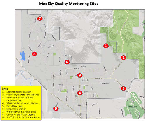
The initial base line sky quality measurements at the 9 locations shown below are planned for January 2019. Thereafter, measurements will be made two to four times a year. Over time, these measurements will tell us if the quality of our night sky is deteriorating or improving.

We can expect deterioration caused by population growth in and around Ivins. But we can reduce that impact by making our outdoor lighting more night sky friendly, and maybe we can reverse some of the deterioration that has already happened.

If you would like to get involved in this project, let us know. Send us an email from the Contact us page.